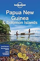
 Solomon Islands Travel Guide - Beaches, Culture & Adventures

.
Travel Notes: Oceania - Solomon Islands Travel Notes.


Short URL: https://tnot.es/SB
Solomon Islands Travel and Tourism on Travel Notes
Explore The Solomon Islands - Where Tropical Island Bliss Awaits
For an idyllic tropical getaway, travel to the awesome Solomon Islands; where every moment is filled with awe-inspiring beauty and unforgettable experiences. Share on Facebook
About The Solomon Islands
The Solomon Islands is made up of more than 35 islands and numerous atolls in the south-western Pacific Ocean.
Visiting the Solomon Islands can be an incredibly rewarding experience due to its stunning natural beauty, rich cultural heritage, and diverse range of activities.

 Add a Business -
Add a Location -
Add a Lodging - Add Travel Content
- Add URL
- Travel Services.
Add a Business -
Add a Location -
Add a Lodging - Add Travel Content
- Add URL
- Travel Services.
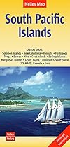
Mapping The Solomon Islands
Map of The Solomon Islands

The Main Solomon Islands
Guadalcanal, New Georgia, Vella Lavella, Choiseul, Santa Isabel, Malaita, and Makira (formerly San Cristobal).
Solomon Islands Overview
The Solomon Islands is a sovereign country located in the Pacific Ocean, east of Papua New Guinea and north-west of Vanuatu.
Brief History
The islands were inhabited by indigenous Melanesian peoples for thousands of years before European explorers arrived in the 16th century.
The islands were colonised by the British and the Germans in the late 19th century, and later by the Japanese during World War II.
After the war, the Solomon Islands became a British protectorate until gaining independence in 1978.
Challenges
The Solomon Islands face various challenges, including limited infrastructure, high levels of poverty, and vulnerability to natural disasters such as earthquakes, cyclones, and tsunamis.
Political instability and ethnic tensions have also been significant issues in the past.
Culture
The Solomon Islands is home to a diverse range of cultures and tongues, with over 70 languages spoken throughout the islands.
Traditional customs and practices remain important in many communities, including music, dance, and storytelling.
Economy
The economy of the Solomon Islands is primarily based on agriculture, fishing, forestry, and mining.
The country also relies heavily on international aid and remittances from Solomon Islanders living abroad.
Tourism is a growing industry, with the islands' natural beauty attracting visitors interested in diving, snorkelling, and ecotourism.
Geography
The Solomon Islands is an archipelago consisting of nearly 1,000 islands, most of which are uninhabited.
The major islands include Guadalcanal, Malaita, Santa Isabel, Choiseul, and Makira.
The capital city, Honiara, is situated on the island of Guadalcanal.
Government
The Solomon Islands is a constitutional monarchy with a parliamentary system of government.
The head of state is the British monarch, represented by a governor-general, while the head of government is the Prime Minister.
The Parliament consists of a single chamber, the National Parliament, with members elected by popular vote.
Natural Beauty
The Solomon Islands are renowned for their stunning natural beauty, including pristine beaches, lush rainforests, and vibrant coral reefs.
The islands offer opportunities for outdoor activities such as hiking, birdwatching, and kayaking, as well as cultural experiences with local communities.
Visiting The Solomon Islands - Choose Your Islands
The Solomon Islands is a fascinating and culturally rich destination, offering a unique blend of natural beauty, history, and diverse cultural traditions.
The Solomon Islands consist of nearly 1,000 islands, so it's important to decide which ones you want to visit.
Guadalcanal, where the capital city Honiara is located, offers historical sites from World War II, as well as beautiful beaches and diving spots.
Other popular islands include Malaita, Santa Isabel, Choiseul, and the remote and pristine Solomon Islands of the Western Province.
Accommodation
The Solomon Islands offer a range of accommodation options to suit every budget and preference, including luxury resorts, eco-lodges, guesthouses, and homestays.
You can choose to stay in Honiara for easy access to amenities and attractions, or venture to more remote islands for a secluded getaway.
Activities
The Solomon Islands offer a wide range of activities for visitors.
Snorkelling and diving are particularly popular due to the region's diverse marine life and coral reefs.
You can explore WWII wrecks, vibrant coral gardens, and encounter marine species such as manta rays, dolphins, and reef sharks.
Surfing, kayaking, and sport fishing are also popular activities.
Cultural Experiences
Immerse yourself in the rich cultural heritage of the Solomon Islands by visiting local villages, attending traditional ceremonies, and experiencing local customs and traditions.
You can learn about traditional crafts, music, dance, and cuisine, and interact with friendly locals.
Getting Around
Domestic flights, boats, and ferries are the primary modes of transportation between islands in the Solomon Islands.
It's essential to plan your travel in advance, as transportation options can be limited and schedules may vary.
Hiring a local guide or joining a tour can also help you navigate the islands and make the most of your visit.
Historical Sites
Learn about the Solomon Islands' fascinating history by visiting World War II sites, such as the Guadalcanal American Memorial and the Vilu War Museum.
You can explore battlefields, bunkers, and memorials that offer insight into the region's wartime history.
Natural Attractions
Explore the Solomon Islands' stunning natural landscapes, including lush rainforests, cascading waterfalls, volcanic peaks, and pristine beaches.
Hike through tropical forests, birdwatch in remote wilderness areas, and relax on secluded beaches surrounded by turquoise waters.
Solomon Islands - Historical Background
The Spanish navigator, Alvaro de Mendana de Neyra, visited the region in 1568, and gave the Solomon Islands their name.
Two hundred years later, the northern islands were explored by Louis Antoine de Bougainville.
Although geographically speaking, Bougainville and Buka are part of the Solomon Islands; politically, they are a part of Papua New Guinea.
At the end of the nineteenth century, the Germans controlled the northern Solomons, while the British declared a protectorate over the central and southern Solomons.
Bougainville and Buka were transferred to the British in 1900.
The Japanese occupied most of the Solomons during World War II, with heavy fighting on and around Guadalcanal.
Solomon Islands gained independence from Britain, on July 7th, 1978.
Guadalcanal
Map of Honiara

Guadalcanal is the largest island; where the capital Honiara is situated.
Where to Stay on Guadalcanal
Remember to respect local customs and traditions, and take care to preserve the Solomon Islands' pristine natural environment during your visit.
With its breathtaking scenery, vibrant culture, and warm hospitality, the Solomon Islands offer an unforgettable travel experience.
Solomon Islands Travel
Solomon Islands Travel Guides.
Weather in The Pacific:
Local weather forecasts for destinations around the Pacific region.


|
|

More From Travel Notes
Travel Notes Online Guide to Travel
Africa - Asia - Caribbean - Europe - Middle East - North America - Oceania - South America.

The Travel Notes Online Guide to Travel helps visitors plan their trip with country and city travel guides, local tourist information, reviewed web sites, and inspiring travel content.
Travel and Tourism Guides on Travel Notes
 If you find Travel Notes useful, please take a moment to
like us on Facebook and share with your friends on social media.
If you find Travel Notes useful, please take a moment to
like us on Facebook and share with your friends on social media.
Share on Facebook
Travel Resources
.
Travel & Tourism With Industry Professionals.